Hi-Resolution LiDAR Contour Base Map

$325.00

Develop a customized contour base map to aid the design and development of your homestead into your multi-generation family heirloom property.

Deliverables include:

  • Map Layers
    • Contour layer from LiDAR data (as tight as 1 foot) appropriate to your property size and desired planning scale.
    • Hillshade layer with contour overlay for easy visualization of your landform.
    • Aspect layer detailing which directions each part of your property is facing.
      • This is very helpful when planning where to build and how to orient structures, establish food forests, orchards or other cropping systems,ย  where to house livestock etc.
    • Slope layer detailing slope gradients across your property.
      • This is very helpful for planning access routes, determining where driving vehicles and machinery across slopes is safe, spacing and sizing for earthworks etc.
  • Files will be provided for viewing your map in:
    • Google Earth Pro (.kml) – for 3D viewing. Download Google Earth Pro for free here.
    • 2D .jpeg or PDF files at whatever size you desire (we have had clients print whole-property posters as big as 42″ x 92″ from large, high-definition .jpeg files)

NOTE: Before purchasing, please check if your property is covered by the existing USGS LiDAR data set by following the steps below. If you have LiDAR coverage of your property, we can develop maps for you. If you feel overwhelmed by all of this techy stuff, just reach out to us via the contact form and we can check for you!

  1. Visit the USGS TNM v.2.0 App Downloader page to view existing LiDAR data set coverage for the continental U.S.
  2. Search for your desired location by address (top right of the map pane) or GPS coordinates (top left in the sidebar in the Area Of Interest options).
    • Alternatively, you can also create a property boundary outline in Google Earth (step-by-step video guide) or Google Maps (step-by-step video guide), and upload the .kml file in the Advanced Search section in the left sidebar and the USGS server will find your property for you.
  3. In the Area Of Interest section in the left sidebar, select the appropriate method to outline the AOI.
    • You can trace your exact property boundary, or the extent of any contributing watersheds that generate run-on that passes through your property, by using the Polygon tool. Hit Return once you have outlined your AOI.
  4. Once the AOI is outlined, in the left sidebar under the Data section, check the box next to Elevation Products (3DEP). From the drop down menu select 1 meter DEM if available. Once the desired data type is selected, click Show underneath it to see if that data is available for the designated AOI. You will see the color of the map change, and if your AOI is within that newly colored area, Digital Elevation Model (DEM) data is available.
    • NOTE: If your property does not have DEM coverage, try selecting the Elevation Source Data (3DEP) – LiDAR, IfSAR box, selecting LiDAR Point Cloud (LPC) from the drop down menu options, and clicking Show. This data will take a little more processing, but we can still use it to generate a high-definition contour map for you.

Description

Homesteads succeed or fail based upon how well integrated your productive systems are with each other and the land.

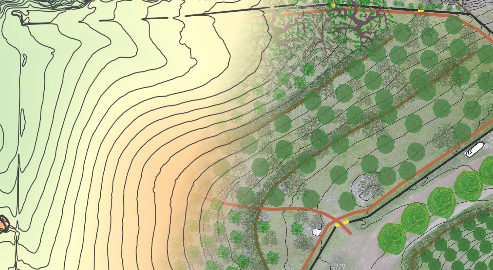
Designing your homestead gets a whole lot easier when you have a base map with contour lines spaced at intervals that are appropriate to your design context and scale.

Contour maps provide the big picture of how:

  • Water is moving through your property – quickly and easily identify the areas where water flows should be re-patterned to optimize the productive capacity and decrease the annual maintenance of your entire property. Optimizing water is the unfair advantage that almost all landowners leave on the table – get your whole-property slowing, spreading and sinking water into its soils and a whole world of options will open up!
  • Access for vehicles, animals and people should be retrofitted, adjusted or installed to maximize 4-season functionality while simultaneously minimizing annual and lifetime maintenance costs. Functional, low-maintenance access is based on a holistic understanding of how water moves across your property.
  • Structures should be sited, oriented and co-located to maximize energy efficiency, functionality, security, and enjoyment while minimizing maintenance, heating and cooling costs, and initial cost of construction (if building new). If you inherited existing structures, understanding their place within the landscape and the natural energies they are subjected to because of it will help you select the most appropriate retrofits to make them more energy efficient and functional for your needs while decreasing long-term maintenance.
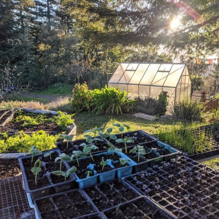
  • Living Systems should be selected, established and managed to optimize yields and minimize inputs. This is where the rubber meets the road in making your homestead a sovereign homestead. What kinds of yields does your homestead property need to produce to provide for your Highest Quality of Life? What are the species (plants, animals, fungi etc) that will thrive based on what the land is trying to become? How can you select and pattern them so that the products and wastes of one are food for another? The process of developing your own sovereign base of production starts with having a complete understanding of what you are working with – and this starts with the shape, slope, and aspect of your land.